How's Your Commute?
I sure don't mind mine, which consists of walking across the living room, but this one seems pretty exciting...
Stitch and Figgy on the Appalachian Trail & Beyond
I sure don't mind mine, which consists of walking across the living room, but this one seems pretty exciting...
Posted by
Ben
at
1:13 PM
0
comments
![]()
Topics: people, technology, transportation
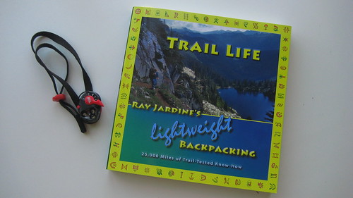
I've been enjoying Ray Jardine's re-worked edition of Beyond Backing, now called Trail Life. Lauren picked it up for me as my Christmas gift, and I've been taking my time soaking it in as nighttime reading before bed.
The main difference in the format is that it now includes hundreds of color photos of Ray and Jenny's adventures. Also different, is that Ray presents most ideas in a "This worked for us, it might not work for you..." tone, which may ruffle a few less feathers. Personally, I didn't mind the how-to tone of the previous format, but this one works as well, and may be less off-putting to the doubters.
I'm only partway done, but am looking forward to reading a section near the end where Jenny writes about their experiences from her perspective, which I don't believe she's previously done.
Great job on the new book Ray and Jenny.
Posted by
Ben
at
3:23 PM
1 comments
![]()
A few years ago I read the account of Dick Proenneke with great fascination and admiration. At age 51, he built a cabin by hand in a remote part of Alaska, then spent the next 35 years meticulously documenting his solitude with photography, video footage and writings.
His narrated video is available on DVD, and this clip is well worth a look if you have 10 minutes.
Posted by
Lauren
at
8:49 PM
2
comments
![]()
Topics: history, people, photography, technology
My friend Adrian just finished the Tour Divide race, a bike ride along the Continental Divide from Canada to Mexico. That's a long time in the saddle. Congrats Adrian!
Adrian writes:
[These photos were] taken along the Great Divide Mountain Bike Route, from Banff, Canada to Antelope Wells, New Mexico (border of Mexico) from June 13 to July 7. This is the longest mountain bike route in the world at 2711 miles with 200,000 ft of climbing. But don't worry, half of it was downhill :-) My odometer clocked it at 2830 miles with the one detour I had in Grand Teton National Park to go to a bike shop for repairs, and the many times I made a wrong turn along the way. 15 riders lined up in Banff to race the route, 14 guys and one girl. 6 guys dropped out, 6 guys finished so far, and 3 riders are still riding in the monsoonal rains of July in New Mexico.
Posted by
Ben
at
2:48 PM
1 comments
![]()
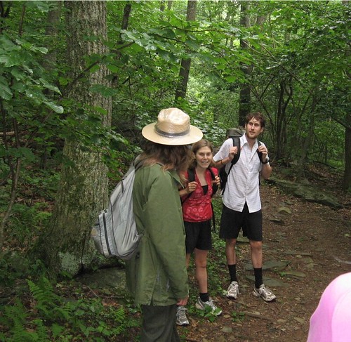
We have a Google alert that automatically notifies us any time someone posts the phrases "Stitch and Figgy" or "Figgy and Stitch" to the web.
This one was kind of interesting: I guess the guy in the green shirt in our photo posted this image to his web album here.
Be careful about what you write about “Stitch and Figgy!”
Posted by
Ben
at
7:50 AM
0
comments
![]()
Topics: people, photography, post-trip
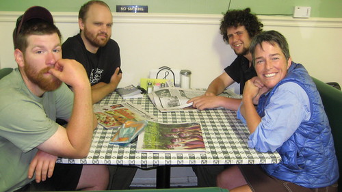
One of the main attractors (or detractors) of hiking the Appalachian Trail is the number of other long distance hikers out there. Even if you start out late, as we did, you're bound to run into the 'herd' of hikers at some point. For us, that began around the halfway point, when we reached Boiling Springs, PA.
If you prefer solitude, the A.T. is probably not the trail for you. But if you can drop some of those expectations and embrace the unique traits that distinguish A.T. from other trails, interacting with the hiking community can be enjoyable.
As a fun challenge, last week Lauren and I began compiling a list of every long distance hiker that we personally met on the A.T. this summer. Our list of trail names can be found here.
Some of these were section hikers and some were aspiring thru-hikers. Some we met for 5 seconds, a few became recurring parts of our journey, and with some we shared a deeper connection.
We were actually surprised by how many hikers we met over the summer, probably because we were covering slightly more mileage than most. In total we were able to remember over 225 people that we met on our journey, simply because they adopted a unique trail name.
Posted by
Ben
at
7:04 AM
0
comments
![]()
When on the trail, Lauren and I go by our trail names "Stitch" and "Figgy" for reasons I describe in this post.
Over the course of the trail we've had a few people either mis-hear our names, or forget them and make some improvements. We thought we'd share some of our favorites below:
Stitch:
Posted by
Ben
at
12:03 PM
0
comments
![]()
(Phone Message Transcribed by Bethany)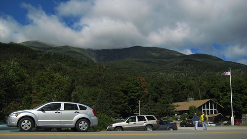
Today is September 1, 2007. It's 10:30 in the morning and Figgy and I just pulled into the Pinkham Notch visitor center which is an absolute zoo. I guess the Labor Day weekend day hikers are out in full force. I can’t remember exactly, but I believe we’ve covered about 1,850 miles now. We’ve had awesome weather through the Presidentials. We saw another 2 moose this morning on our hike into the visitor’s center!
We are headed over some very challenging terrain as we go over Wild Cat peaks A, B, C, D, and E. It looks like we’ll be headed into Gorham NH by tomorrow night. That’s where we plan to take a couple of days off to do some trail work with our friends Sally and Tom from the ATC. We are doing well. We’re just having a blast and are so thankful to be over the extreme peaks and the harsh weather of the high Presidentials. That’s about it for now. By tomorrow evening we will be so close to Maine it’s not even funny!
Over and Out.
(Phone Message Transcribed by Bethany)
Today is Saturday, August 11, 2007. Lauren and I are standing in North Adams, Massachusetts. I’m looking at East Mountain ahead of us, which is the border of Massachusetts and Vermont which we will hit in just a few minutes when we leave town here. It’s also the southern terminus of Vermont’s Long Trail which the AT coincides with for the next 100 miles. 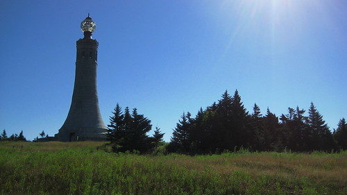
Yesterday, it poured on us all day long. It was cold and rainy, but things cleared up in the evening and we were greeted with an amazing view and sunrise on top of Mount Greylock, which is the highest point in Massachusetts. Since then, temperatures have been amazingly comfortable; we’re looking at low 50’s at night and high 70’s during the day, without a cloud in the sky. It’s been quite ideal hiking conditions. 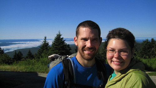
We’ve met up with our friends He-Man and She-ra, and we’ve been enjoying the morning walking with them. Life is good, and we’re happy to be out here. I guess you wait all summer for days like this! It’s hard to describe but everything is clicking and we’re feeling good.
Over and Out.
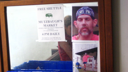
At about 6'5" and 275 pounds, "Sled Dog" made an immediate impression on us when we returned to Hot Springs, NC after our weekend at Trail Days. Before we'd even known him for two minutes, he informed in his southern drawl that he's from Alaska, his wife died in a terrible auto accident, he spent the last 12 years with the Special Forces in Iraq and that he rode his dog sled from Alaska to Montana to get to the trail.
When you're out on the trail your radar for people is pretty sharp, but it didn't take much to realize that "Sled Dog" was someone who didn't quite add up. He carried a small day pack full of Moon Pies, wore combat boots up to his knees, and had two memorable tattoos on his left shoulder - "Sexy" and "Save a Horse, Ride a Cowboy."
At this point "J.D." (as he introduced himself to us) had only been out on the trail for a few days, claiming he began his journey south at "Newfound'ers Gap" in the Smokies.
We ended up having several interactions with him on the trail north of Hot Springs. After a few times of him asking "How far we goin' today?" and "Where's the next water source?" I asked him why he chose not to carry a map or data book. After several sketchy interactions we sped up and finally lost him in Erwin, TN where he passed us and has been north of us ever since.
In that short time we gathered far too many funny things that he said to post here, but I've included some highlights.
Posted by
Ben
at
6:47 AM
0
comments
![]()
Topics: people
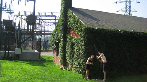
This morning we grabbed a quick shower at a powerplant along the trail here in Connecticut, and then walked a few more miles into town.
Salisbury, CT (Mile 1484.2)
Today is out 6th year anniversary and we spent the morning walking along the Housatonic River making our way to Salisbury, CT. We'll be taking the rest of Saturday off along with Sunday and enjoy the charm of this quintessential New England town.
Tonight we'll enjoy a dinner at the White Hart Inn. Tomorrow we'll no doubt be spending some time at The Roast Coffee House. When we head out on Monday morning we're 7.3 miles from the Massachusetts line and the Birkshire Mountains.
We haven't seen a tick for days and couldn't be happier.
- - - -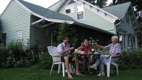
UPDATE: We ended up staying with a fiesty 78 year old German woman with a sharp tongue and a great sense of humor. Maria takes hikers into her home and treats them like family. We shared our anniversary picnic dinner in her yard and had a wonderfully memorable stay.
Posted by
Ben
at
10:51 AM
4
comments
![]()
The Appalachian Trail meanders through a landscape strewn with American history. The problem is that I usually donn't know what I'm looking at. I find myself seeing things such as this beautifully laid chimney picture below and having plenty of questions without anyone to ask.
Who were the people who lived here? Why did they leave? Am I looking at a Civil War remnants, the modest dwelling of a reclusive subsistence farmer, or was this area even a thriving center of life at one point?
The forests had changed so much in the last 200 years. At one point nearly every tree east of the Mississippi has been cut down so it is sometimes impossible to picture what was once here. A thick forest of today may have been an apple orchard just 100 years ago.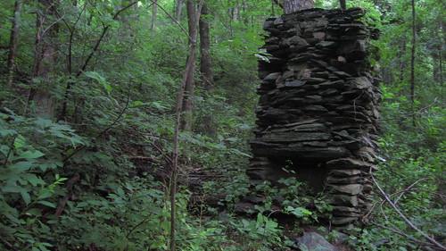
Fortunately our hosts for the night, Walt and Pat, were able to tell us a little bit about this chimney we passed yesterday morning. It is the remains of the old Lowe House, where 10 children grew up and the men would walk the 5-10 miles into Waynesboro to sell their crops.
For me, the most compelling remnants on the trail were from the Brown Mountain Creek Community pictured and described below.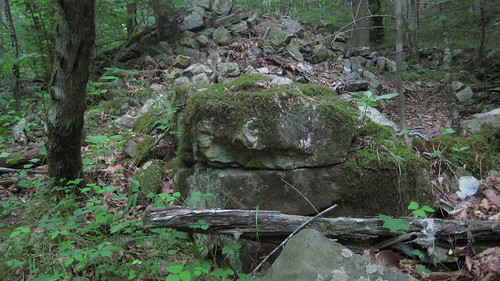
The Appalachian Trail strolls for 1.4 miles through this shady valley that was once the site of a share-cropping community of freed slaves.
This was a very powerful area to walk through, experiencing so much human history woven into the landscape. In my mind I could hear could hear the songs of those proudly working the first piece of land they could call home and the laughter of children playing in the chilly creek.
It was established in the early 1900's and disbanded in the 1920's when the Forest Service purchased the land for the Appalachian Trail. Makes me wonder if they voluntarily sold it or were more-or-less run off the land.